Skansen Kronan and Gothenburg's Hilltop Forts: The View from the Ramparts
Gothenburg was built inside a moat, and the hills just outside that moat were fortified so cannon could look down on anyone approaching the city. Two of those forts still stand, and the view from the ramparts is the best free panorama of Gothenburg, Sweden you can get.
Short answer
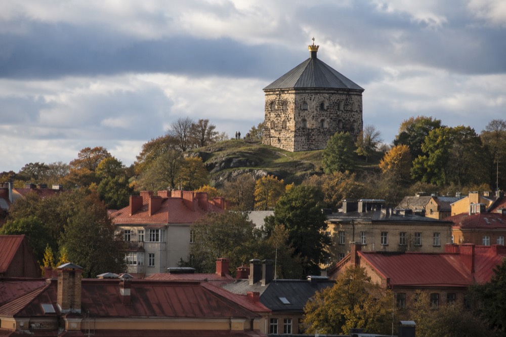
Skansen Kronan is a restored hilltop fort above the Haga district in Gothenburg, Sweden, a short uphill walk from central tram stops, with a panoramic view over the city, the Göta älv and the archipelago. Admission to the hill and the outside of the fort is free, and the climb takes roughly ten to fifteen minutes from Haga.
Gothenburg's founders were Dutch, and they built the city the Dutch way: a grid of streets inside a wet moat, with earthen ramparts instead of stone walls. The hills around that moat were too high to leave in enemy hands, so the Swedish crown fortified them. Two of those hilltop strongpoints survive within walking distance of the city centre, and they are the reason this page exists. Skansen Kronan sits above Haga on the hill the fortifications map calls Risåsberget, and its twin, Skansen Lejonet, stands on Gullbergsklippan a little further east. Neither fires a shot these days. What they offer instead is the finest free panorama in Gothenburg, Sweden, over red tile roofs, church spires, the Göta älv, the harbour cranes and, on a clear day, the archipelago out to sea.
What Is Skansen Kronan in Gothenburg?
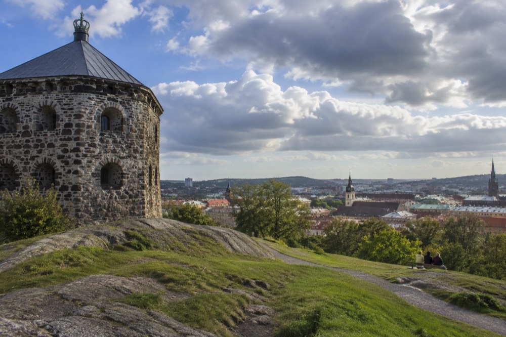
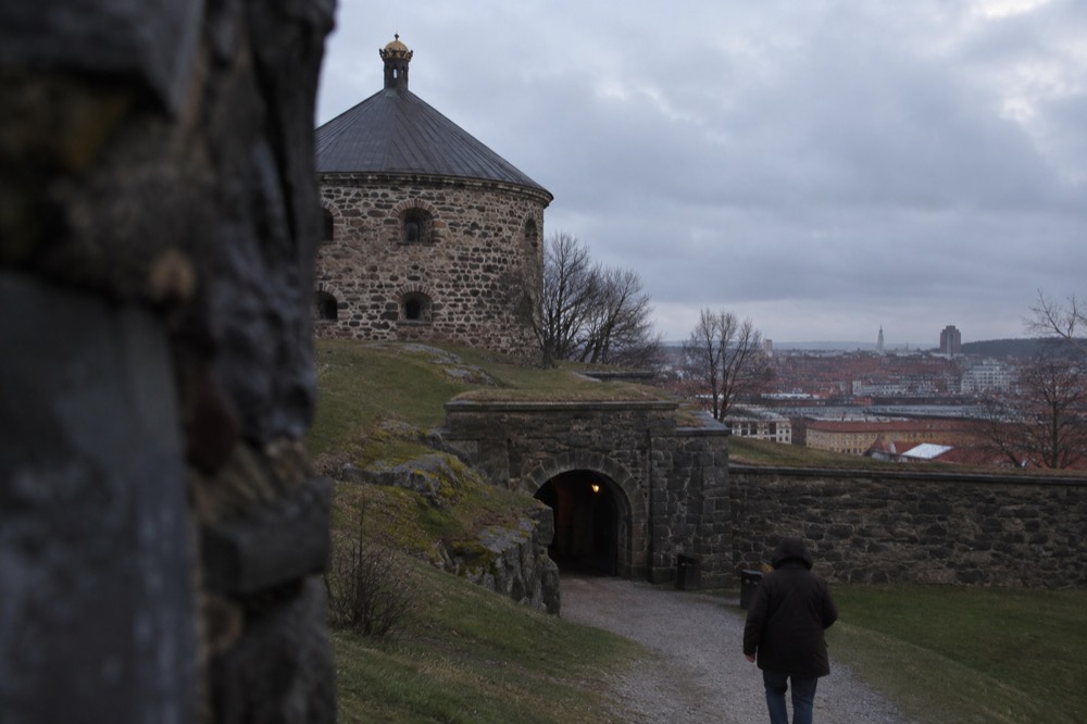
Skansen Kronan is a historic hilltop fort on Risåsberget above the Haga district of Gothenburg, Sweden, built as part of the city's outer defences so that artillery on the hill could command the approaches to the walled town below. It is a squat, star-shaped stone work crowned by a round tower, and today the hill, the ramparts and the view are freely accessible on foot, with the tower itself used as an event and conference space rather than a museum.
The fort belongs to a defensive idea rather than a single building. The old town inside the moat, the area still called Inom Vallgraven, could be flooded and held, but a besieging army on the surrounding hills would have made life miserable for the garrison. The answer was to fortify the hills first. Skansen Kronan and Skansen Lejonet were the two main works, close enough to the walls to support them and high enough to see an attacker coming. That height is now the whole attraction. The military logic of the original fortifications delivered a viewing platform that no modern building in the city has matched for the price of a walk.
The building has had several lives since the guns left. It has served as a museum of military history, a storage place, and in recent decades a venue for conferences and private events, which is why the tower is not permanently open as an attraction. The exterior, the ramparts and the surrounding parkland are the public part, and they are open around the clock like any city park. Visitors who arrive expecting a staffed museum with ticket counters and fixed hours will be disappointed, so plan for a self-guided hilltop walk rather than an indoor exhibit. The neighbouring Gothenburg Cathedral and Inom Vallgraven guide covers the lowland old town the fort was built to protect.
How Do You Get to Skansen Kronan?
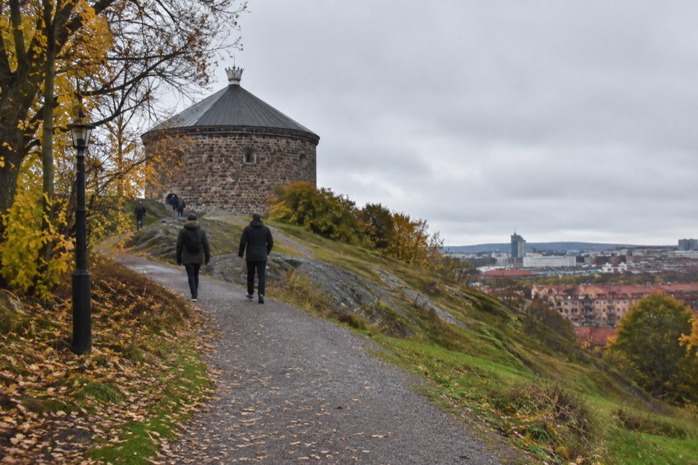
The usual way to reach Skansen Kronan is by tram to the Hagakyrkan or Linnéplatsen stops and then a ten to fifteen minute uphill walk through the Haga district and past the base of the hill, with the final stretch on gravel paths through the wooded slope. There is no road to the top and no parking up there, so the climb on foot is part of the visit for everyone, and the walk from Järntorget takes about twenty minutes in total.
The tram is the natural tool for this. Gothenburg's network runs twelve lines over 188 kilometres of single track, according to Göteborgs Spårvägar's own annual report, and Haga is stitched into it from every direction. A single adult ticket in one zone costs 38 kr, and a 24-hour Zone A day ticket costs 125 kr at the same price in the app or at a shop, per Västtrafik's Zone A ticket page. The hill sits inside Zone A, so the ordinary single covers it. If you are also riding out to the islands the same day, the same Zone A ticket covers the archipelago ferries from Saltholmen, which makes the fort a sensible morning stop before an afternoon boat. The getting around Gothenburg trams, tickets and zones guide has the full fare detail.
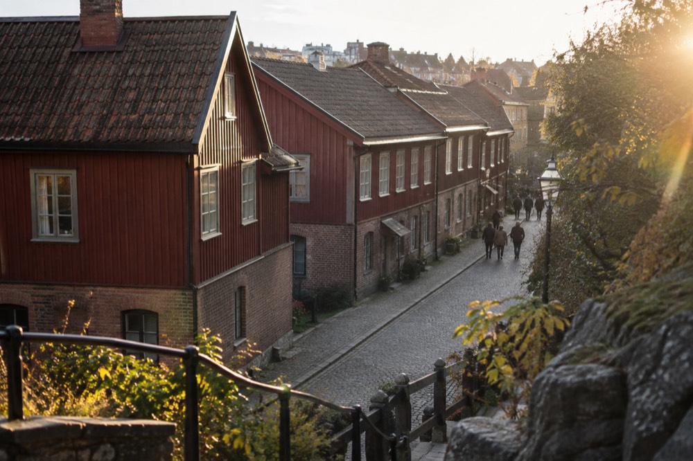
The climb itself is the honest part. From the Haga side you enter through the wooden-quarter streets, past the landshövdingehus painted fronts, and the path steepens through trees for the last stretch. Steps and gravel make it manageable in ordinary shoes in dry weather, but it is not a wheelchair route, and in winter ice on the north-facing paths is a real consideration. Anyone planning a wider accessible itinerary should read the site's notes on cobbles, trams and museums. Coming down, the descent into Haga lands you directly in the café zone, which is where the fika tradition of the neighbourhood takes over, and the fika in Gothenburg guide lists the classic rooms.
If you are building a day around the city rather than just the hill, the sightseeing boats give you the water-level half of the same story: the moat the forts defended. Here are the three most useful options, all bookable through the operator's live listing.
Skansen Kronan or Skansen Lejonet: Which Gothenburg Fort Should You Climb?
Skansen Kronan is the fort to climb for the view and the atmosphere: it sits above Haga, the walk up passes the city's most photographed wooden quarter, and the panorama over the centre, the river and the sea is the wider and better one. Skansen Lejonet, on Gullbergsklippan near Gullbergskaj, is the more complete-looking fortress building with a lion-sculpted gateway, but its hill is lower, its surroundings are less charming, and most visitors give it a look from below rather than a full visit.
Skansen Lejonet deserves better than it usually gets. The building is the more fortress-like of the two, a proper round tower with bastioned works, and it has served time as everything from a prison to a private club. But its setting on a rock above the approach to the river means the view is more industrial than romantic: bridges, terminals and the mouth of the Göta älv rather than rooftops and spires. Photographers who want the working-harbour version of Gothenburg should go there instead. Everyone else should put the walk into Haga first and let Skansen Kronan win on setting. The wider set of guides lives on Gothenburg Travel Guide.
There is a third option worth naming, because the honest answer to "which hilltop" sometimes is neither fort. Ramberget on Hisingen, the hill above the Eriksberg shipyard cranes, gives a skyline panorama with the whole city laid out across the water, and locals use it far more than the forts. The trade-off is distance: Ramberget needs a bus or a long cycle ride, while Skansen Kronan is a stroll from anywhere central. For a short visit, the fort above Haga is the efficient choice.
| Skansen Kronan | Skansen Lejonet | Ramberget | |
|---|---|---|---|
| District | Above Haga, west of centre | Gullbergsklippan, east of centre | Hisingen, north of the river |
| Climb | 10-15 min from Haga | 5-10 min from Gullbergskaj | Access road and paths, longer trip |
| Best view over | Old town, rooftops, river mouth, archipelago | Bridges, harbour, river approach | Full city skyline from across the water |
| Setting | Wooden quarter, cafés, woodland | Industrial and terminal edges | Park and shipyard district |
| Cost | Free | Free | Free |
What Can You Actually See from the Top?
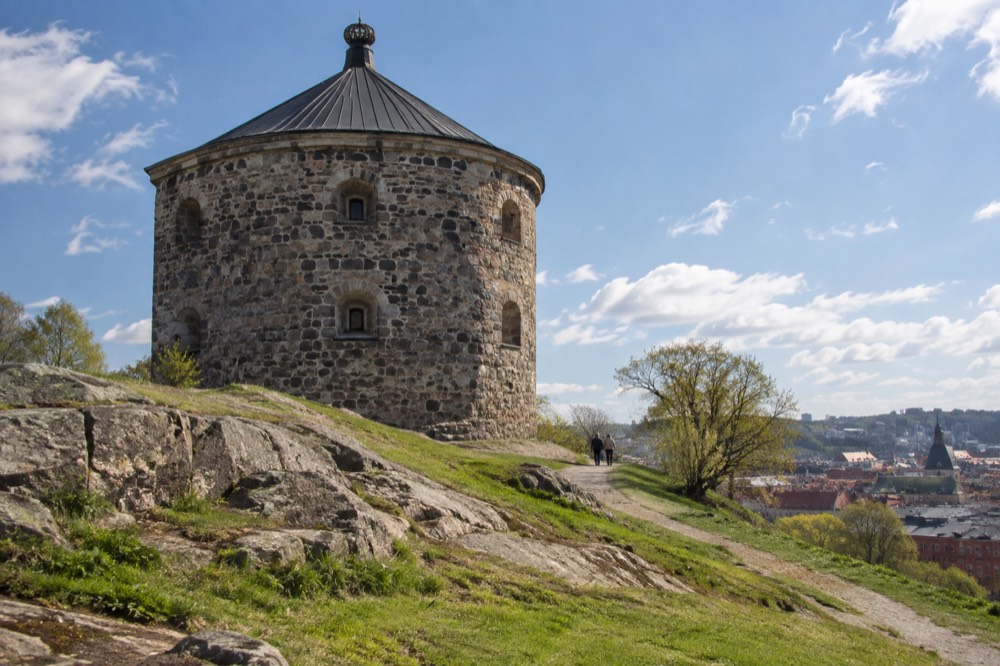
From the ramparts of Skansen Kronan you can see the whole of central Gothenburg, Sweden at a glance: the grid of the old town inside the moat, the tower of the cathedral, the domed Haga church immediately below, the Göta älv winding toward the harbour, and, on clear days, the islands of the southern archipelago and the coast of Bohuslän on the horizon. It is the only free vantage point where the city's whole geography, river, grid, hills and sea, fits in one view.
The view rewards a little knowledge of what you are looking at, so here is the orientation, working clockwise from the west. The detail that surprises people is how legible the historic plan still is from above: the moat that once defended the town is now a green canal, and the Paddan sightseeing boats that run it trace the exact line the fortifications drew. For the boat-side version of that story, the Paddan boats and the canal sightseeing route guide covers the water-level experience, and the Paddan cruise on the River Säveån is bookable below.
| Direction | What you are looking at |
|---|---|
| West and southwest | Haga's wooden rooftops, Linnégatan, and beyond it the mast of Maritiman and the harbour |
| North | The Göta älv, the bridges, and the Hisingen side with its shipyard heritage |
| East | The city grid inside the old moat, the cathedral tower, and office blocks of Nordstan beyond |
| Southeast | Avenyn's treetops and, on clear days, the Göteborgs konstmuseum area at Götaplatsen |
| South and far horizon | On clear days, hints of the archipelago islands and open sea toward the Kattegat |
One dated fact belongs here, because the southeast view will change. Göteborgs konstmuseum, the art museum at Götaplatsen, closes in 2028 for a rebuild and extension and reopens in 2032, per the museum's own project page, which also warns of intermittent blasting near the building right now. Anyone photographing that side of the skyline over the coming years is photographing a construction site in the making. The Gothenburg Museum of Art guide has the visit details while it is still open.
Why Does Gothenburg Have Forts on Its Hills?
Gothenburg has hilltop forts because the city itself was deliberately built low and flat inside a moat on marshy ground at the mouth of the Göta älv, which made the town easy to flood and defend but left the surrounding hills as a threat, so the crown fortified the nearest high ground to stop a besieger siting artillery above the walls. The forts are the high-ground half of a defensive system whose lowland half, the moat, is still visible today as the canal around the old town.
The Dutch engineers who laid out Gothenburg in the early seventeenth century were the era's experts in water defence, and they chose a site where the river could be let into ditches around a compact grid. That design worked against a storming party. It did nothing about the hills a cannon could trundle up. Fortifying those hills was the fix, and the two skanser were placed to cover the western and eastern approaches respectively. The names survive in the city's vocabulary: a skans is a small detached fortification, and these two gave their names to the hills they sit on.
The defensive value faded quickly, as it did for most old fortresses once artillery could reach farther than a hilltop battery, and the city eventually grew up around and past them. What remained was parkland, and that is the second act worth appreciating: the slopes below Skansen Kronan were deliberately kept as wooded hillside rather than built over, which is why central Gothenburg still has a wild-ish green hill five minutes from the tram. The city's other great free green space, Slottsskogen, plays the same role further south, and the Slottsskogen park and its free zoo guide covers it.
When Is the Best Time to Climb?
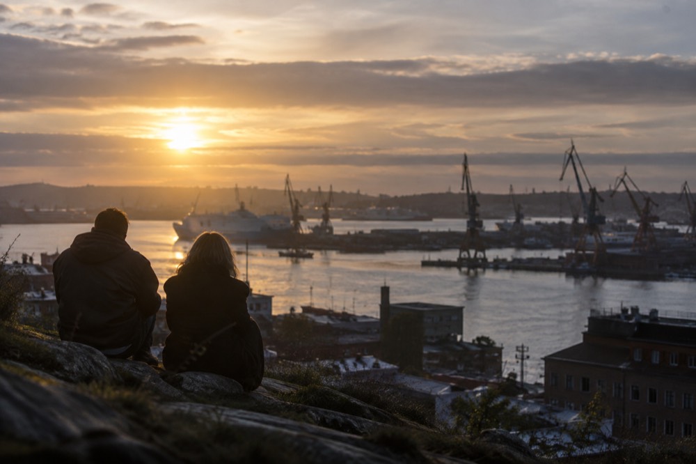
The best time to climb Skansen Kronan is a clear evening between May and September, when the light lasts longest and the low sun lights up the western rooftops and harbour, though April is statistically the driest month of the year in Gothenburg, with 51.3 mm of rain on 8.2 wet days per SMHI's 1991-2020 normals, and October is the wettest at 102.9 mm, so spring offers the most reliable views and autumn the most dramatic ones.
The daylight arithmetic matters more here than in most cities. Gothenburg sits at 57.7 degrees north, and the US Naval Observatory's tables give the city 18 hours 06 minutes of daylight on 21 June against 6 hours 32 minutes on 21 December, a swing of over eleven and a half hours. A June or July evening climb gives you a view that stays usable until absurdly late, with civil twilight running past 23:30 local time. A December visit gives you a narrow window: the sun rises at 08:54 and sets at 15:26, so plan a late-morning arrival if you want daylight on the rooftops. The daylight and darkness in Gothenburg month by month guide unpacks the seasonal trade-offs.
Do not write the city off as a rainy lost cause, because the data does not support the cliché. SMHI's 1991-2020 normals for station Göteborg A give 912 mm of precipitation across about 127 days a year, roughly one day in three, and SMHI's own climate pages put the national rainfall maxima in the western highlands and the mountains, not in the city. October is the wettest month, which is worth knowing because that is exactly when many visitors arrive for autumn colour. The best time to visit Gothenburg guide has the full seasonal picture.
| Season | Daylight feel | Rain risk | Verdict for the climb |
|---|---|---|---|
| Spring (Mar-May) | Lengthening fast, April driest month (51.3 mm) | Lowest | Most reliable views |
| Summer (Jun-Aug) | 18 h 06 m daylight on 21 Jun | Moderate | Best for late-evening panoramas |
| Autumn (Sep-Nov) | Shortening, October wettest (102.9 mm) | Highest | Dramatic light, pack rain gear |
| Winter (Dec-Feb) | 6 h 32 m daylight on 21 Dec | Moderate, icy paths | Short window, ice underfoot |
How Do the Forts Fit Into a Day in Gothenburg?
The efficient pattern is to climb Skansen Kronan in the morning from Haga, descend into the wooden quarter for fika, then spend the afternoon at water level, because the fort, the old town and the moat are all within a fifteen-minute walk of each other and the whole loop is free apart from food and any boat ticket. Two days is the comfortable total for the city, with the forts, Haga and the canal on day one and Liseberg or the archipelago on day two.
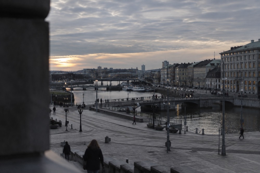
The pairing that works best is fort and boat. The hill gives you the city as a map, and the canal cruise gives you the city as a fortress, from the waterline the ramparts were designed around. The amphibious bus tour is the middle option, driving the streets and then plunging into the moat itself, and it is a strong pick for visitors who want the fort's story with none of the climbing. Families doing this loop with children usually add Universeum, whose entry ticket is bookable below, or Liseberg in season, and the Liseberg rides, tickets and when to go guide explains why the park's calendar matters: in 2026 the summer season runs 18 April to 20 September, and a 95 kr entry ticket buys zero rides, so check the season and the ride-pass pricing before promising anyone a rollercoaster.
For the itinerary-shaped version of all this, the two days in Gothenburg plan slots the Haga climb into a first morning, and the Universeum science centre guide is the wet-weather alternative when the 127-wet-days-a-year statistics catch up with you. If a longer stay is on the table, the islands are not a day trip in the bureaucratic sense, they are areas of the city, reached on the same ticket as the tram that brought you to the hill, and the Gothenburg archipelago guide covers the southern ferry network.
Here are the three bookable options that pair best with a fort visit, from the water-level view of the moat to the islands beyond the horizon.
Of the three, the archipelago cruise is the one that connects most directly to what you saw from the ramparts: the islands on the horizon, seen a few hours later from the deck of a boat. It runs 2.5 hours with a guide on board, and the operator's live listing carries the current departure times.
Common Questions About Skansen Kronan and Gothenburg's Hilltop Forts
Is Skansen Kronan free to visit?
Yes. The hill, the surrounding parkland and the exterior of the fort are public space with no charge and no ticket, open like any city park. The tower interior is used as an event venue and is not a permanently staffed museum, so the visit is essentially the climb, the ramparts and the view, all free.
How long does it take to walk up to Skansen Kronan?
The climb from the Haga district takes roughly ten to fifteen minutes on gravel paths and steps, and about twenty minutes total from Järntorget including the walk through the wooden quarter. Allow half an hour on the hill itself to walk the ramparts and take in the view in more than one direction.
Can you go inside the Skansen Kronan tower?
Not as a regular visitor. The tower functions as a conference and event space, so the interior opens for booked functions rather than public sightseeing. The outside works, the gateway and the rampart level are the public experience, and they deliver the panorama.
Which is better, Skansen Kronan or Skansen Lejonet?
For most visitors, Skansen Kronan: the walk up passes Haga's wooden quarter, the hill is higher and the panorama over the old town, the river and the sea is wider. Skansen Lejonet is the more fortress-like building and suits photographers who want the working-harbour view of bridges and terminals instead.
Is the walk to Skansen Kronan suitable for wheelchairs or prams?
The final stretch is gravel path and steps with a steady gradient, so it is not a wheelchair route and it is awkward with a pram in winter. In icy conditions the north-facing paths hold frost and the climb is best saved for a dry afternoon. The lower slopes through Haga are flat and manageable for everyone.
What is the best time of day to photograph from Skansen Kronan?
A clear evening between May and September, when the low sun lights the western rooftops and the harbour and the light lasts late, with civil twilight past 23:30 in late June. In winter the window is narrow, sunrise 08:54 and sunset 15:26 on 21 December, so aim for late morning.
The forts were built so a garrison could see trouble coming. Four centuries later the trouble never came and the view stayed, which is the quiet joke of the place: Gothenburg's best lookout was engineered for a war that never arrived, and every visitor who climbs the hill collects the dividend. Pair it with a boat through the moat below and you have the whole city, high and low, in one afternoon.