Best Photo Spots in Gothenburg, Sweden: Where to Point Your Camera
Gothenburg, Sweden photographs better than its reputation suggests: granite hills, painted wooden houses, shipyard cranes and a car-free archipelago that sits inside the city's own tram and ferry zone. This guide lists the viewpoints, streets and islands that deliver, and the light conditions that decide whether the shot works.
Short answer
The best photo spots in Gothenburg, Sweden are Skansen Kronan for the old town rooftops, Masthuggskyrkan for the harbour and Älvsborg bridge, Ramberget on Hisingen for the skyline, Haga's wooden houses, Feskekôrka's fish-church architecture, and the southern archipelago islands reached by ordinary Västtrafik ferry from Saltholmen.
Gothenburg, Sweden was built by Dutch engineers inside a moat, and the city still photographs the way it was laid out: a compact stone core, granite hills rising straight out of the street grid, and a working harbour that never left. The tram network, 12 lines and 188 km of single track as of the 2022 Göteborgs Spårvägar annual report, threads all of it together, which matters for a photographer because the best locations are scattered across four districts and an island chain. The southern archipelago is not a day trip at all. It is part of the city, car-free, and covered by an ordinary Zone A ticket, so the same 125 kr day pass that carries your tram carries the ferry to the islands too.
This guide walks through the locations in the order you would realistically shoot them, then covers light, seasons and gear, because in a city at 57.7 degrees north the light is the variable that makes or breaks every frame.
Where Are the Best Photo Spots in Gothenburg, Sweden?
The best photo spots in Gothenburg, Sweden are the hilltop forts and church terraces that overlook the old town and harbour, the painted wooden quarter of Haga, the fish-church hall Feskekôrka, the canal route through the moat, and the car-free southern archipelago islands of Styrsö, Brännö and Vrångö, all of which sit inside the ordinary Västtrafik Zone A ticket area.
Gothenburg's photographic identity is Nordic maritime: grey sea light, red brick, granite, painted wooden landshövdingehus houses and the cranes of the former shipyards still standing on the riverbank. Unlike Stockholm, where the classic shots are palace-fronted water, Gothenburg rewards a working-harbour eye. The shipyard heritage at Lindholmen and Eriksberg, the fishing villages inside the city limits, and the 19th century stone streets of Vasastan give the city a texture that reads differently in every season.
The practical advantage is access. The viewpoints are free, the islands cost a tram-and-ferry fare, and the compact core means a determined photographer can cover the old town, Haga and two harbour terraces in a single long afternoon. For the wider picture of how the city fits together, see our guide to two days in Gothenburg.
Which Gothenburg Viewpoints Give the Best Skyline Shots?
Skansen Kronan gives the classic old town rooftop shot, Masthuggskyrkan's terrace frames the harbour and the Älvsborg bridge, and Ramberget on Hisingen offers the widest skyline panorama of the whole city. All three are free to visit, and each faces a different direction, so between them they cover morning, midday and evening light.
Skansen Kronan is the 17th century hill fort in Haga, and its ramparts are the highest free platform over the moat-and-rooftops core. Shoot here in the morning, when the low sun comes in over the east and rakes across the tiled roofs. The climb is short but steep, and the fort's stone crown itself is a strong foreground shape.
Masthuggskyrkan, the church on the Masthugget hill, has a terrace that looks straight down the Göta älv toward the Älvsborg bridge. This is the harbour shot: ferries, tugs, the bridge cables and, in the middle distance, the cranes of the north bank. Late afternoon and sunset work best here because the bridge faces west. Our Masthuggskyrkan and the best city viewpoints guide covers the walk up and the other terraces in the same district.
Ramberget, the hill inside Keiller's park on Hisingen, is the one locals use. The panorama takes in the whole city skyline, the river and both bridges. It is the only viewpoint of the three you can drive or bus to within a few minutes' walk of the top, which makes it the reliable choice in bad weather when the light breaks for ten minutes.
| Viewpoint | What you shoot | Best light | Access |
|---|---|---|---|
| Skansen Kronan | Old town rooftops, moat, Haga | Morning | Steep 10 minute walk from Haga |
| Masthuggskyrkan terrace | Harbour, Älvsborg bridge, shipyard cranes | Afternoon to sunset | Tram to Stigbergstorget, then uphill |
| Ramberget / Keiller's park | Full skyline panorama | Any time, strongest at dusk | Bus or car partway up |
If you would rather scout the city's geography from the water first, the amphibious bus tour below drives the street circuit and then enters the harbour itself, which is a fast way to see how the viewpoints line up before you walk to them.
Between the amphibious tour and the island cruises there is a real difference in what they are for. The bus is a scout: one hour, the street grid and the harbour, useful for planning your walking days. The archipelago boats are a shoot in themselves, with stable decks and island approaches the public ferries do not take. If your trip is short, the pass option below can also bundle several paid locations into one decision.
What Are the Best Photo Spots in Gothenburg's Old Town and Haga?
The best old town photo spots in Gothenburg are the moat-side canal at Lilla Bommen, the cobbled streets inside Inom Vallgraven, Feskekôrka's fish-church building on Rosenlundsgatan, and in Haga the preserved wooden houses of Nygatan and the giant cinnamon-bun cafés of Sprängkullsgatan, all within a 20 minute walk of each other.
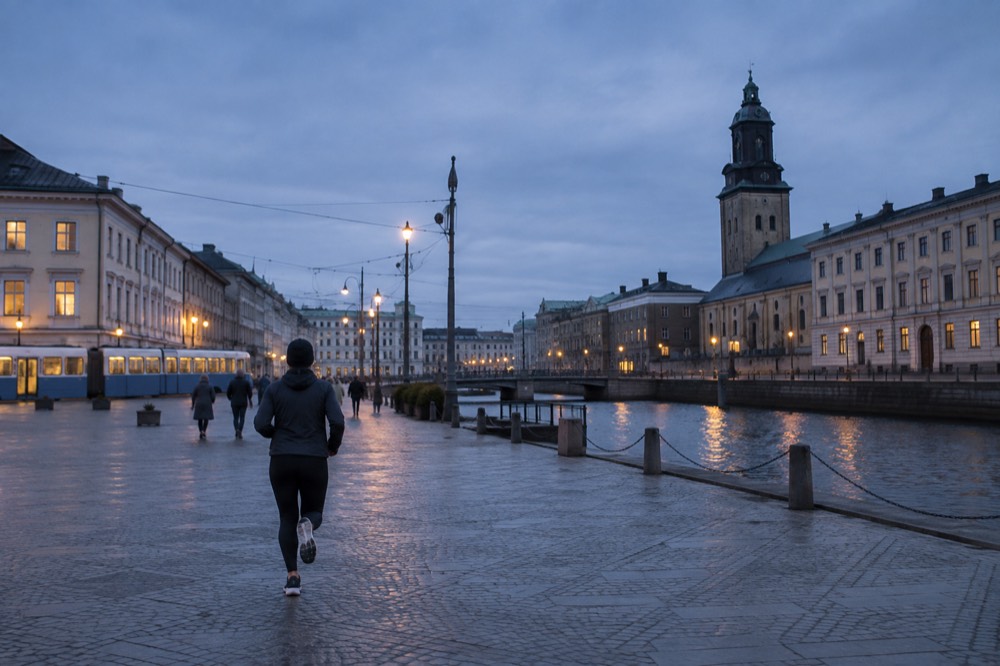
The Inom Vallgraven district, the streets inside the old moat, is where the 17th century Dutch plan survives. The canal that replaced the northern moat is the single most photographed waterline in the city, and the Paddan boats that run along it give you a low camera position from the water. Our Paddan boats and the canal sightseeing route guide covers the trip. Shoot the canal in mid-morning before the tour boats stack up.
Feskekôrka, the fish market hall whose name means "fish church" because it looks like a Gothic church turned sideways, reopened in 2024 after renovation as a food hall with two fish counters and five restaurants. The building turned 150 the same year, so it dates from 1874. Architecturally it is the most distinctive interior in the city centre, and the fish counters make strong detail shots. The Feskekôrka the fish church guide lists what is inside now, which matters because older guides describe a building that no longer exists in that form.
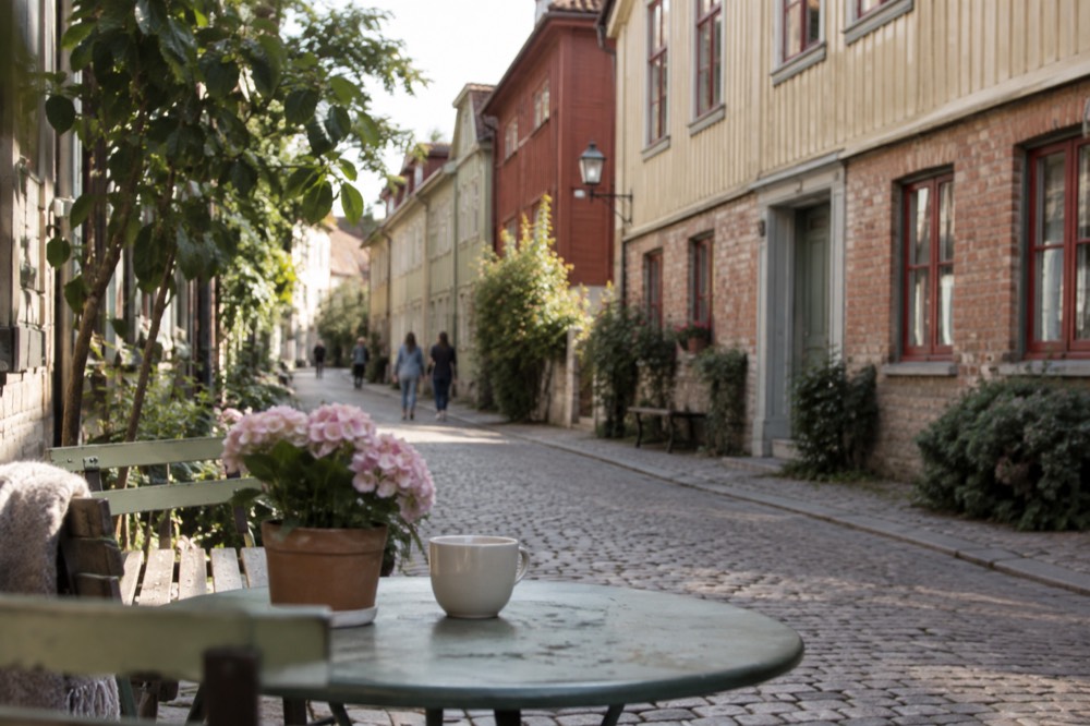
Haga is the wooden quarter. The landshövdingehus style, one stone floor and two timber floors above, painted in strong ochres and reds, lines Nygatan and the lanes running off it. The light in Haga is narrow and side-on, which suits detail work: doorways, window frames, the café interiors. Järntorget, the square at the district's western end, is the wide shot. For the district's full story, see what Haga is known for on our blog.
Where Can You Photograph Gothenburg's Archipelago and Water?
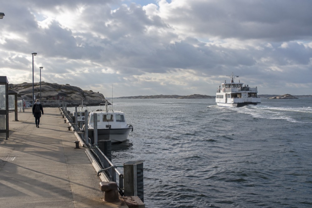
The southern archipelago islands of Styrsö, Brännö, Vrångö, Donsö, Asperö and Köpstadsö are the best water photography locations, reached by Västtrafik ferry from Saltholmen, which is itself the western terminus of the tram network. An ordinary Zone A ticket covers both the tram and the ferry, and private cars are banned on all of these islands.
This is the fact that changes how a photographer plans Gothenburg. The islands are not an excursion requiring a car or a tour booking. You ride tram line 11 to Saltholmen, step onto a Västtrafik ferry, and a 125 kr 24-hour Zone A ticket covers the whole chain, as Västtrafik's own zone A ticket page shows. Västtrafik's wording is that you can ride the same ticket all the way from the centre out onto the sea.
Brännö is the island of red boathouses and grazing meadows, flat and walkable, with a village core that photographs like a 19th century fishing settlement because much of it is one. Vrångö, the furthest south, has the longest beaches and the most open horizon. Styrsö, the largest, has four villages and a small hill at Halsö headland. Because the islands are car-free, per Göteborgs Stad's own planning documents, the roads are footpaths, and the ferry docks themselves are strong foregrounds. Everything else covered here is indexed on Gothenburg Travel Guide.
For the crossing itself, a guided archipelago cruise gives you a stable deck, a commentary on the islands and a route past the Vinga lighthouse approaches, which is the shot most visitors miss because the public ferries loop inside the sheltered channels.
The northern archipelago, Öckerö, Hönö and Björkö, is a different shoot: bridge-connected, more open to the sea's swell, and home to the granite slabs and fishing harbours that read as Bohuslän. Our northern archipelago guide covers it, and the Gothenburg archipelago overview explains which island suits which trip.
| Island | Signature shot | Ferry line from Saltholmen | Terrain |
|---|---|---|---|
| Brännö | Red boathouses, meadows, village lanes | Direct | Flat, easy walking |
| Vrångö | Open beaches, horizons | Via Donsö | Flat to rolling |
| Styrsö | Four villages, Halsö headland views | Direct | Mixed |
| Donsö | Working fishing harbour | Direct | Flat |
| Köpstadsö | Small dock, cliff swimming spots | Direct | Rocky |
Back in the city, the harbour itself deserves a session. Röda Sten, under the Älvsborg bridge's south tower, gives you the bridge from below with the river traffic behind, and the Klippan harbour village on the same bank is the oldest settlement in the city, all timber and boat sheds. The Röda Sten and the Älvsborg bridge and Klippan and the old harbour village guides cover both on foot.
What Are the Best Museum and Architecture Photo Spots in Gothenburg?
Götaplatsen with the Poseidon statue and the art museum steps is the best architecture shot in the city centre, the Göteborgs konstmuseum building itself is the most monumental facade, and inside the museums the standouts are the fish-church hall Feskekôrka and the Universeum rainforest hall, though the konstmuseum is scheduled to close in 2028 for a rebuild that lasts until 2032.
Götaplatsen, the top of the Avenyn boulevard, is where the art museum stands behind Carl Milles' Poseidon fountain. Shoot it early, before the café tables fill the steps, and from the fountain side so the museum's columns close the composition. The konstmuseum's own site states the closure plan plainly: the museum closes in 2028 and reopens in 2032, and there is intermittent blasting near the building right now. If the museum's facade and steps are on your list, the coming years are the window. Our Gothenburg Museum of Art guide has the visiting detail.
The stone streets of Vasastan, the district north of the moat, give Gothenburg its most Berlin-like frames: heavy 19th century apartment blocks, chestnut avenues and student cafés. The Vasastan guide maps a walk. Slottsskogen park, the huge green space in the south of the city, mixes free animal enclosures with avenues that tunnel into light, and the Slottsskogen park guide covers it. Slottsskogen is free, which makes it one of the best entries on our free things to do in Gothenburg list.
One warning that matters for planning: the Volvo Museum at Arendal closed permanently in December 2023, and its successor, World of Volvo, opened in 2024 at Lyckholms Torg, as World of Volvo's own site states. Older photo-location lists still send people to the Arendal building, which is a closed site. The World of Volvo guide has the current address and hours.
When Is the Best Light for Photography in Gothenburg?
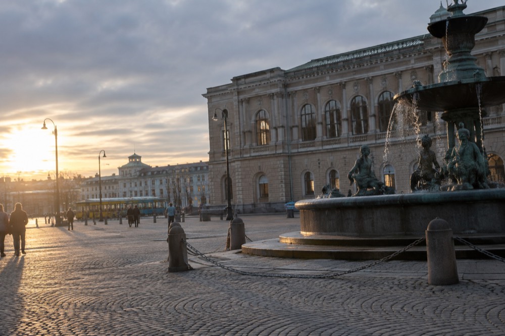
The best light for photography in Gothenburg runs from April to September, with the longest days giving 18 hours 6 minutes of daylight on 21 June against just 6 hours 32 minutes on 21 December, and the sea and the low summer sun making May, August and September the strongest months for water and skyline work.
The daylight swing between the solstices is 11 hours 34 minutes, one of the largest of any city served by this kind of tram-and-ferry network. In June, civil twilight runs from 02:58 to 23:30 local time, leaving roughly three and a half hours of true night, which means golden hour effectively never ends: the sun sets and the sky stays bright enough to keep shooting. In December the usable window is the grey light between 08:03 and 16:17, and the city's stone streets hold what little contrast there is.
The rainfall pattern matters more than the reputation suggests. SMHI's 1991-2020 normals for the Göteborg A station put the city at 912 mm a year across 127 days, with October the wettest month at 102.9 mm and April the driest at 51.3 mm, per SMHI's own normals data series. So the dry window is spring, not summer, and April combines the year's fewest wet days with lengthening evenings. SMHI's own normals pages do not support the repeated claim that Gothenburg is Sweden's rainiest city; the national maxima are in the western highlands and the mountains. The best time to visit Gothenburg guide covers the seasons in full.
For water work, the sea temperature data is counterintuitive and useful. SMHI's quality-controlled observations at the Vinga lighthouse station show the sea peaks in August at 18.6 C, not July, and that September water at 16.7 C is warmer than June water at 16.2 C. So a September archipelago shoot gets warmer light, warmer water and thinner ferry crowds than June. February, at 2.7 C, is the coldest month, with a record low of -1.2 C because brackish Kattegat water does not freeze at zero.
| Month | Daylight character | Photo conditions |
|---|---|---|
| April | Fast lengthening, dry | Driest month, 51.3 mm, spring light on stone |
| June | 18 h 06 m on the 21st | Near-continuous golden hour, no real night |
| August | Long evenings, warm sea | Sea peaks at 18.6 C, harbour haze |
| September | Golden evenings | Sea 16.7 C, warmer than June, thin crowds |
| October | Shortening fast | Wettest month, 102.9 mm, storm light |
| December | 6 h 32 m on the 21st | Grey window 08:03-16:17, Christmas lights |
What Camera Gear and Settings Work for Gothenburg?
A wide lens for the rooftops and harbours, a standard prime for Haga's narrow streets, and weather protection matter more than sensor size, because the city's light is low and flat for much of the year and the sea wind carries spray on the islands. A tripod is only needed for winter dusk work, since June nights barely darken.
The narrow lanes of Haga and the Inom Vallgraven streets punish long lenses; a 28 mm or 35 mm equivalent does most of the street work. From the viewpoints, the skyline from Ramberget spans wide enough that a 24 mm equivalent is comfortable, and the Älvsborg bridge from Masthuggskyrkan's terrace wants something in the 50 to 85 mm range to compress the towers against the river.
On the islands, salt spray and wind are the real constraint, not resolution. A weather-sealed body or at least a good cleaning cloth earns its place on the ferry deck. The ferries themselves are moving platforms, so use a fast shutter speed on the crossing to keep the boathouse shorelines sharp.
Winter changes the kit list. With usable light ending by 16:17 in December, and the Christmas market period from 14 to 23 November at Liseberg as the main night subject, a fast prime and a small tripod cover the evening work. Liseberg's entry ticket from 95 kr includes no rides, as the park's own price page states, but the lights are the photographic reason to go in November, and the Gothenburg Christmas market guide covers the whole season.
| Situation | Lens or setting | Why |
|---|---|---|
| Skansen Kronan rooftops | 24-35 mm equivalent | Wide old town spread below |
| Masthuggskyrkan bridge shot | 50-85 mm | Compresses bridge against river traffic |
| Haga streets | 28-35 mm, wide aperture | Narrow lanes, side light |
| Ferry deck crossing | Fast shutter speed | Moving platform, spray risk |
| December dusk, Liseberg | Fast prime, tripod | Usable light ends by 16:17 |
If your trip mixes photography with the paid attractions, the all-inclusive pass below bundles 20-plus of them, including the harbour-side and museum locations on this list, which can simplify a multi-day shooting itinerary.
A pass makes sense when the itinerary stacks several paid locations on consecutive days; if your trip is built around one or two viewpoints and the free islands, it will not pay for itself. For the full comparison, including how the old Göteborg City Card no longer exists and what replaced it, see our Göteborg city card guide. The three tours below are the ones that pair most naturally with a photography-first trip.
How Do You Plan a Photography Day in Gothenburg?
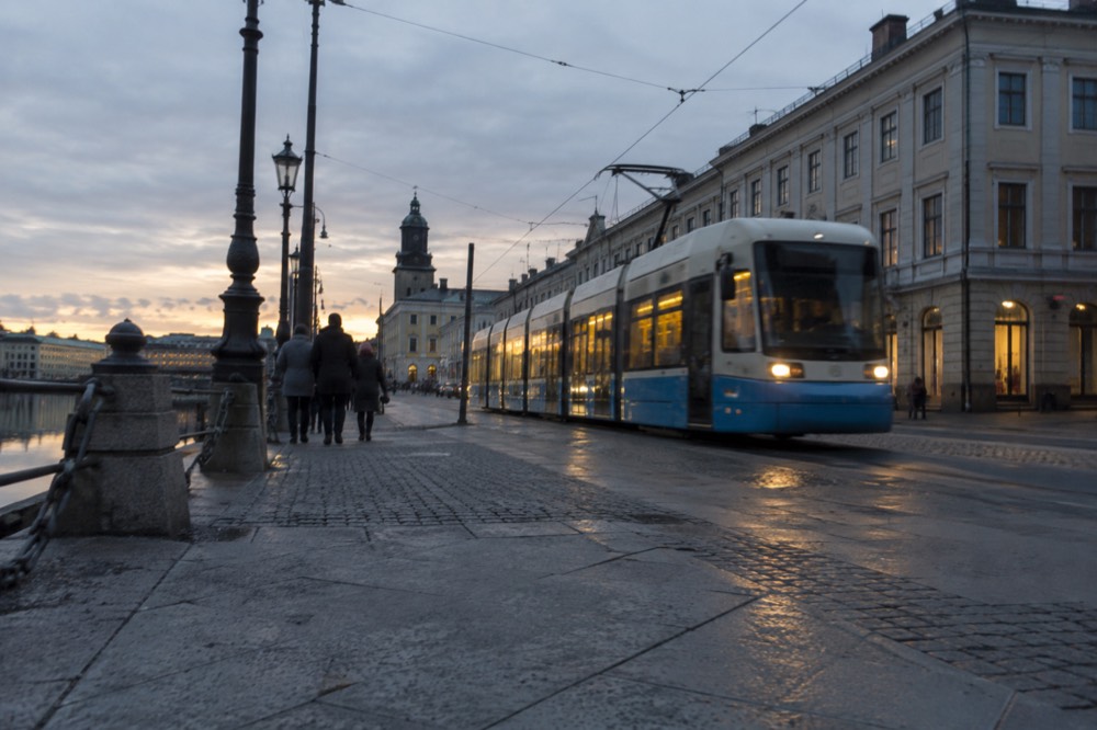
A realistic photography day in Gothenburg starts at Skansen Kronan or Masthuggskyrkan in the morning light, works the old town and Haga at midday, rides the tram to Saltholmen for an afternoon archipelago ferry, and finishes from Ramberget or the Röda Sten bridge tower at dusk, all on a single 125 kr 24-hour Zone A ticket.
The ticket is the organising fact. A 24-hour Zone A pass at 125 kr covers every tram, the airport-adjacent buses within the zone and every southern archipelago ferry. The getting around Gothenburg guide covers the fare system in detail, including the single-ticket prices and the youth fares.
One planning note on the subsidy you may have read about: a temporary state subsidy currently halves Västtrafik's 30-day period tickets, but it does not apply to the 24-hour and 72-hour tickets visitors buy, so do not budget for half-price transport on a short trip.
For a longer stay built around locations, the where to stay in Gothenburg guide maps the districts, and staying in Haga or Majorna puts you within walking distance of two of the three main viewpoints. Majorna, the second-hand quarter between Haga and the river, is itself a strong street-photography district, and the Majorna guide walks it.
Common Questions About Photo Spots in Gothenburg
Where is the best view over Gothenburg?
Skansen Kronan gives the classic old town rooftop view, Masthuggskyrkan's terrace gives the harbour and Älvsborg bridge, and Ramberget on Hisingen gives the widest full-skyline panorama. All three are free.
Can you photograph the Gothenburg archipelago on a day ticket?
Yes. The southern islands are inside Västtrafik Zone A, so a 125 kr 24-hour ticket covers the tram to Saltholmen and the ferries to Brännö, Styrsö, Vrångö, Donsö, Asperö and Köpstadsö.
When is the best light in Gothenburg for photography?
June gives 18 hours 6 minutes of daylight on the 21st, with civil twilight from 02:58 to 23:30, so the evening light barely ends. April is the driest month at 51.3 mm of rain, and September combines golden evenings with sea water warmer than June.
Is Feskekôrka open for photography visits?
Yes. It reopened in 2024 as a food hall with two fish counters and five restaurants, in a building that dates from 1874. The interior is one of the most distinctive architectural shots in the city centre.
Is the Volvo Museum a photo spot in Gothenburg?
No. The Volvo Museum at Arendal closed permanently in December 2023. Its successor, World of Volvo, opened in 2024 at Lyckholms Torg and is the current Volvo-related location.
Do you need a car to reach the photo spots?
No. The viewpoints are walkable or tram-served, and the archipelago islands are car-free anyway, with private cars banned per Göteborgs Stad's own planning documents. The tram network reaches Saltholmen, the ferry terminal, directly.