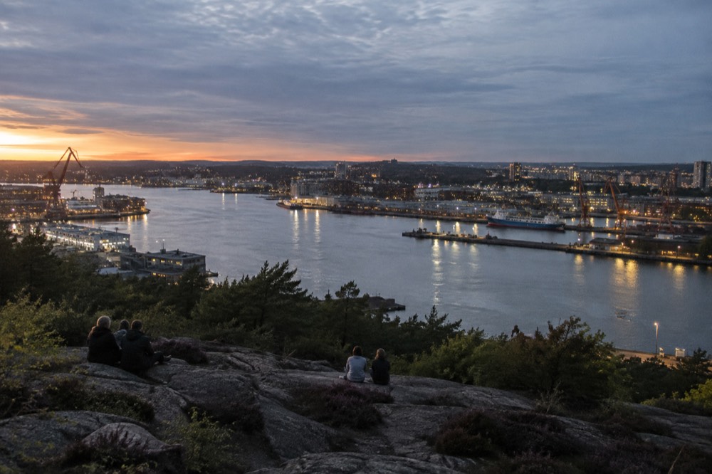
Ramberget in Gothenburg, Sweden: The Skyline View Locals Actually Use
Ramberget, the hill on Hisingen behind Lindholmen, gives Gothenburg its widest skyline view, and unlike the postcard viewpoints it costs nothing and opens whenever you feel like walking up.
Short answer
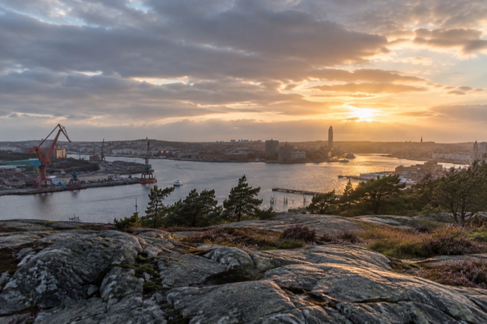
Ramberget is a hilltop park on Hisingen, reached by tram or bus from central Gothenburg in about 15-20 minutes, with a free, always-open panorama over the city centre, the Göta älv and the archipelago horizon.
Ramberget is the hill that locals on Hisingen point to when a visitor asks where to see the city without paying for it. The summit sits in parkland on Gothenburg's island district, high enough that the whole central skyline, the Göta älv river, the harbour cranes and the flat line of the Kattegat all fit into one glance. Göteborgs Stad manages it as open green space, which means no gate, no ticket booth and no closing time. What follows is how the hill fits into a Gothenburg trip: the tram ride out, what the panorama actually contains, when the light cooperates, and what else on Hisingen makes the crossing worth a half day.
What Is Ramberget and Where Is It in Gothenburg?
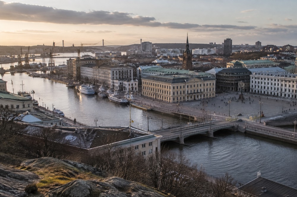
Ramberget is a rocky hilltop park on Hisingen, the large island that makes up Gothenburg's northern half, standing above the Lindholmen waterfront roughly two kilometres upstream from the city centre as the river bends. Its summit parkland is public, free and open around the clock, and it is the one big viewpoint in the city that is not wrapped in a tourist product. The view south and east takes in the central skyline across the Göta älv, and the view west runs out over harbour basins towards the sea. Because it sits on the working side of the river, the panorama includes shipyard cranes and container terminals alongside the spires, which is exactly the mix this port city is built on.
The hill belongs to the everyday geography of Hisingen rather than to any attraction. Residents walk dogs up its paths, runners use the slopes, and the summit is a standard stop on any local's mental map of the district. That is the difference between Ramberget and the church-tower viewpoints across the water: it is infrastructure, not a ticket. For a first-time visitor, that also means no crowds at 9am on a Tuesday.
Context matters for planning. Hisingen is where Gothenburg's industry has always lived, from the shipyards to Volvo's Torslanda works, and the island's own Lindholmen and Hisingen waterfront has grown into a technology and campus district with its own restaurants and hotels. Ramberget sits directly behind that waterfront, so a visit combines naturally with a look at the district below.
The comparison most visitors eventually make is with Masthuggskyrkan, the church on the southern bank whose steps give the classic postcard view. The Masthuggskyrkan and city viewpoints guide covers that side. Ramberget's advantage is scale: from the southern viewpoints you look north at Hisingen, while from Ramberget the whole city centre lies in front of you with the river in the foreground.
How Do You Get to Ramberget from Central Gothenburg?
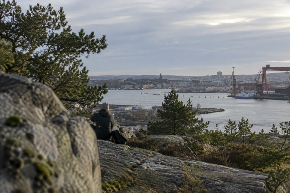
You reach Ramberget by taking a tram or bus across the river to Hisingen, typically to the Lindholmen or Wieselgrensplatsen stops, and then walking uphill for roughly 15 to 25 minutes on park paths; a single Zone A ticket costs 38 kr and a 24-hour Zone A ticket costs 125 kr, covering trams, buses and, remarkably, the archipelago ferries too. Västtrafik's fare table shows the single adult one-zone fare at 38 kr, with youth at 29 kr, and the 24-hour Zone A day ticket at 125 kr whether bought in the app or at a shop. Zone A covers Göteborg, Mölndal, Partille and Öckerö, so one day ticket can carry you up Ramberget in the morning and out to a car-free archipelago island in the afternoon.
The tram network is the reason this works so smoothly. Göteborgs Spårvägar's own reporting describes twelve lines running 188 kilometres of single track across 134 stops, from Saltholmen in the west to Kålltorp in the east and over the bridge to Hisingen, and the network carried 126 million journeys in 2025. Several lines cross the Älvsborg bridge or the river bridges to Hisingen, and from the central stops around Brunnsparken the ride to the Hisingen side takes only a few minutes. The full mechanics, including how to pay and whether you tap out, are covered in the getting around Gothenburg guide.
One live nuance worth knowing before you buy: Västtrafik has a temporary state subsidy running through the end of the year that halves every 30-day period ticket, cutting a Zone A adult monthly from 890 kr to 445 kr. It does not apply to the 24-hour and 72-hour tickets visitors actually buy. Anyone telling you "transport in Gothenburg is half price" is quoting the monthly cut, not your day ticket.
If you are arriving in the city the same day, the airport coach from Landvetter, now branded Vy flygbussarna, runs to Korsvägen and Göteborg Centralstation in a journey Swedavia states takes 20 minutes, and there is no rail link to the airport at all. The airport to city centre guide has the full comparison.
For visitors who want the geography explained while riding it, the amphibious bus tour is the natural pairing with Ramberget. The listing describes a land-and-water sightseeing route rated 4.7 from 4,326 reviews, running about an hour from 36 kr per person, and its harbour leg gives you the view back up at the hill you climbed.
What Can You Actually See from the Top of Ramberget?
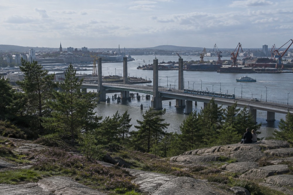
From Ramberget's summit you see the entire central skyline of Gothenburg across the Göta älv, from the masts and church towers of the old town through the Avenyn district's taller blocks, plus the Älvsborg bridge, the harbour and shipyard cranes along Hisingen's waterfront, and on clear days the low outline of the archipelago islands out towards the Kattegat. The river does most of the compositional work: it sweeps through the frame in a wide curve, so the city appears wrapped in water rather than stacked behind itself, which is what separates this panorama from a rooftop-deck view.
The panorama reads as a map of the city's history. In one direction the painted wooden houses and church spires of the old town, laid out by Dutch engineers inside a moat; in another, the cranes and dry docks that built the ships Sweden exported for a century; and between them, the modern glass of Lindholmen's campus quarter directly below. Liseberg's rides and the stadium district around Ullevi are visible on the eastern side, and the Ullevi stadium district guide explains what you are looking at there.
Here is roughly what sits in each direction of the view:
| Direction | What you see | Notes for visitors |
|---|---|---|
| South-east across the river | Central Gothenburg skyline, church towers, Liseberg's tall rides | Best at sunset when the city catches western light |
| South-west | Göta älv estuary, Älvsborg bridge, harbour approaches | Bridge carries trams and road traffic to Öckerö ferries |
| Directly below | Lindholmen waterfront, campus buildings, river promenade | Good for orientation before walking back down |
| West and north | Hisingen's residential slopes, container terminals, cranes | The working-port view most postcards crop out |
| Far horizon on clear days | The flat line of the southern archipelago islands | Same islands the ferries from Saltholmen serve |
Two honest caveats. First, the horizon towards the sea is low and hazy more often than not; the archipelago islands appear as a faint ridge, not a postcard chain. Second, the industrial foreground is not a flaw, it is the point. Gothenburg's own tourism narrative leans on the maritime identity, and Ramberget is where you see it functioning rather than curated.
Is Ramberget Free, and When Is It Open?
Ramberget is completely free and has no opening hours, because it is public parkland rather than an attraction: there is no gate, no ticket, no staffed viewpoint and no closing time, and the paths stay walkable year-round, which makes it one of the most reliable free things to do in Gothenburg at any hour. That matters in a city where the headline attractions have schedules. Liseberg, for instance, runs summer 18 April to 20 September, Halloween 2 October to 1 November, and Christmas 14 November to 23 December, per the park's own ticket page, and is shut for the long stretch from late December to mid-April. Ramberget does not close for any of it.
The free-and-open status also shapes when locals use it. A December visitor gets barely 6 hours 32 minutes of daylight on the solstice, per the US Naval Observatory's figures for this latitude, with sunrise at 08:54 and sunset at 15:26. Ramberget at 15:00 in December is a real outing; Liseberg at the same hour might simply not exist. The city's broader free options are collected in the free things to do guide, and the seasonal trade-offs, including the December light problem, are worked through in Gothenburg in winter.
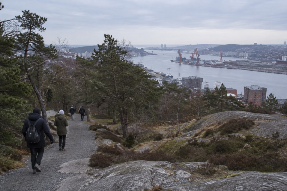
Practical notes for the walk up: paths are a mix of gravel and rock, footwear matters more in wet months, and the slopes are gentle enough that the climb is a stroll rather than a hike. There are no facilities at the summit to speak of, so carry water in summer and expect wind at the top in any season. The hill faces open river air, and that breeze is part of what keeps the view clear.
When Is the Best Time of Day and Year for the Ramberget View?
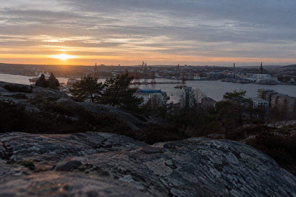
The best light on Ramberget is late evening in June, when the sun sets after 22:00 and civil twilight lingers until 23:30, but the best months overall are April and May, which SMHI's 1991-2020 normals show as the driest stretch of the Gothenburg year, with April at just 51.3 mm of rain across 8.2 wet days. June and July give you the longest usable evenings, but they also bring the peak visitor crowds to everything below. April gives you dry ground, fresh green on the slopes and a city that has not yet filled up.
The rainfall pattern is the planning fact most visitors get backwards. The wettest month in Gothenburg is October at 102.9 mm, not a summer month, and the driest is April at 51.3 mm. The annual total of 912 mm falls across about 127 days, roughly one day in three. And despite the city's damp reputation, SMHI's own national analysis does not call Gothenburg Sweden's rainiest city; the national maxima sit in the western highlands and the mountains. The full seasonal breakdown is in the best time to visit guide.
| Month | Rainfall (mm) | Wet days (≥1 mm) | Mean air temp (°C) | Verdict for the view |
|---|---|---|---|---|
| January | 83.0 | 11.5 | 0.8 | Short days, often crisp and clear |
| April | 51.3 | 8.2 | 7.7 | Driest month, long evenings arriving |
| June | 73.7 | 10.0 | 15.7 | Sunset after 22:00, twilight till late |
| July | 81.3 | 9.8 | 18.3 | Warmest air, peak crowds below |
| September | 80.0 | 10.8 | 14.0 | Warm sea, quieter paths |
| October | 102.9 | 12.6 | 9.0 | Wettest month, dramatic skies |
Data: SMHI 1991-2020 normals, station Göteborg A (71420).
The June daylight is worth spelling out because it changes what a viewpoint visit means. On 21 June the sun is up from 04:11 to 22:17, 18 hours 6 minutes of daylight, and civil twilight runs from 02:58 to 23:30, leaving only about three and a half hours of true night. You can walk up Ramberget at 21:30 in full evening light. In December the same walk needs to happen by mid-afternoon. The month-by-month detail lives in the daylight and darkness guide.
What Else Should You Do on Hisingen Around Ramberget?
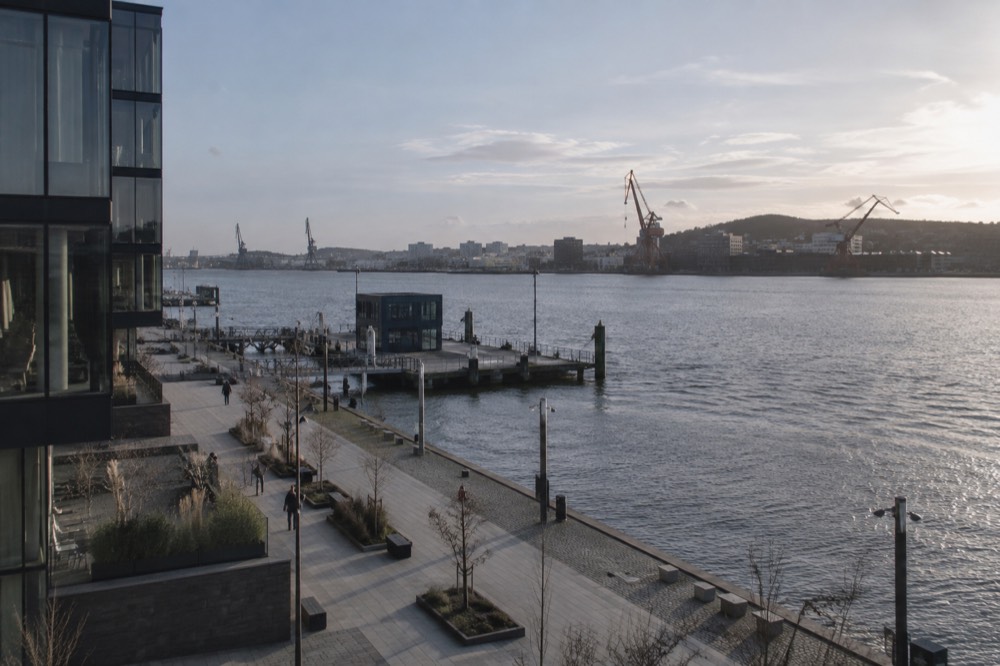
Hisingen rewards a half day: pair the Ramberget climb with the Lindholmen riverfront directly below, the floating maritime history at Maritiman back across the bridge, and a look at the Älvsborg bridge area, all reachable on the same Zone A ticket you used to get out here, before finishing with food back in the city centre. The island is not a day trip, it is a district of Gothenburg, and its waterfront has quietly become one of the more pleasant walks in the city.
A reasonable loop: tram to the Hisingen side, walk the Lindholmen promenade along the river, climb Ramberget from the waterfront side, come down into the residential slopes, and tram back across. If you want the city explained while you cover similar ground, a canal cruise gives the river-level version of the same geography; the listing shows a 50-minute canal sightseeing cruise from 28 kr per person, rated 4.7 from 783 reviews.
For the view from a moving boat instead, the archipelago cruise with guide runs 2.5 hours from 44 kr per person and is rated 4.4 from 1,488 reviews; it heads out from the harbour past the very cranes you saw from the summit.
Eating afterwards is easy. Cross back to the city side and the where to eat guide covers the neighbourhoods, including Feskekôrka's reopened food hall, where five restaurants and two fish counters now operate inside the 1874 building. If the afternoon is fading into evening, the fika guide explains the coffee-and-cinnamon-bun ritual that will carry you to dinner. And if you want a sit-down view to complement the standing one, the Avenyn and Götaplatsen district's cafés are a short tram hop from the river.
Can You Combine Ramberget with the Archipelago on One Ticket?
Yes, and this is the single best-value move in Gothenburg: a 125 kr 24-hour Zone A ticket covers the tram to Hisingen for Ramberget in the morning and the archipelago ferries from Saltholmen in the afternoon, because Västtrafik's boats to the car-free southern islands are ordinary Zone A services, the same as the trams. Västtrafik's own material says you can ride on the same ticket all the way from the centre out onto the sea, and the islands, including Styrsö, Brännö, Donsö and Vrångö, sit inside Zone A. Private cars are banned on them, per a Göteborgs Stad study that describes the southern archipelago as protected from car traffic.
The logistics work because Saltholmen, the ferry terminal, is the western terminus of the tram network. You ride a tram to the boat, then the boat to the islands. The how to get to the archipelago guide and the southern archipelago guide cover the crossings in detail, and the wider Gothenburg archipelago page explains which island suits which day.
Timing the swim matters more than most visitors expect. SMHI's quality-controlled observations from the Vinga station show the sea peaks in August at 18.6 C, not July, and that September water at 16.7 C is actually warmer than June water at 16.2 C. A September archipelago afternoon is warmer to swim in than a June one, which is the opposite of what most people book.
| Sea temperature at Vinga | Jan | Feb | Mar | Apr | May | Jun | Jul | Aug | Sep | Oct | Nov | Dec |
|---|---|---|---|---|---|---|---|---|---|---|---|---|
| Mean (°C) | 3.9 | 2.7 | 4.1 | 7.1 | 11.6 | 16.2 | 18.3 | 18.6 | 16.7 | 12.8 | 9.3 | 5.5 |
Data: SMHI oceanographic archive, station 35144 Vinga, quality-controlled hourly observations. February, not January, is the coldest month for the water, and the brackish Kattegat has recorded lows below zero there.
Common Questions About Ramberget in Gothenburg
Is Ramberget free to visit?
Yes. It is public parkland with no gate, no ticket and no closing time. You only pay for the tram or bus ride to Hisingen, and a single Zone A ticket costs 38 kr.
How do I get to Ramberget from central Gothenburg?
Take a tram or bus across the river to the Hisingen side, to stops around Lindholmen or Wieselgrensplatsen, then walk uphill on park paths for roughly 15 to 25 minutes. The ride from Brunnsparken takes only a few minutes.
What can you see from Ramberget?
The full central skyline across the Göta älv, the Älvsborg bridge, the harbour and shipyard cranes along the Hisingen waterfront, the Lindholmen district below, and on clear days the low outline of the archipelago islands towards the sea.
When is the best time to go up Ramberget?
April and May for the driest weather, per SMHI's normals, or a June evening, when the sun sets after 22:00 and twilight lasts until 23:30. In December you need to be up there by mid-afternoon, as the day runs under seven hours.
Can you combine Ramberget with the archipelago islands?
Yes. A 125 kr 24-hour Zone A ticket covers the tram to Hisingen and the archipelago ferries from Saltholmen, since the boats are ordinary Västtrafik Zone A services. Climb the hill in the morning, ride out to the islands in the afternoon.
Is Ramberget suitable for children?
The slopes are gentle and the paths are family-friendly, though there are no facilities at the summit. The climb pairs well with the riverfront walk below, and the wider Gothenburg with kids guide has more options on Hisingen and beyond.
Planning a Day Around the View
A day built around Ramberget costs almost nothing by Gothenburg standards: the only transport spend is 125 kr per adult for 24 hours of trams, buses and ferries, the hill itself is free, and the natural shape is a morning on Hisingen, a midday lunch back in the centre, and an afternoon out on the water, all stitched together by one ticket. If Ramberget becomes the anchor of a day, the rest writes itself. Morning on Hisingen: tram across, riverfront walk, climb, panorama. Midday back in the centre for lunch, with Feskekôrka's food hall as the maritime-flavoured option. Afternoon out to sea on the same day ticket, or along the canal if the weather turns. Evening wherever the light points, which in June is anywhere at all, given the sky stays usable until nearly midnight.
The is Gothenburg expensive guide breaks down what the rest of a trip adds up to, and the city pass guide explains what the current [Go City](https://gocity.tpk.ro/HQKyKKW4) product does and does not cover, since the old Göteborg City Card no longer exists.
One last planning note for anyone building an itinerary around viewpoints: the how many days do you need question depends heavily on whether you count Hisingen and the archipelago as separate outings. Ramberget, done properly with the waterfront below it, is a half day. Add the islands and it becomes a full one. This site, Gothenburg Travel Guide, exists to keep those distinctions honest, because the hill and the islands are the two things most rushed itineraries quietly drop.